Description
16 Full Color Charts 11 x 17, Spiral Bound
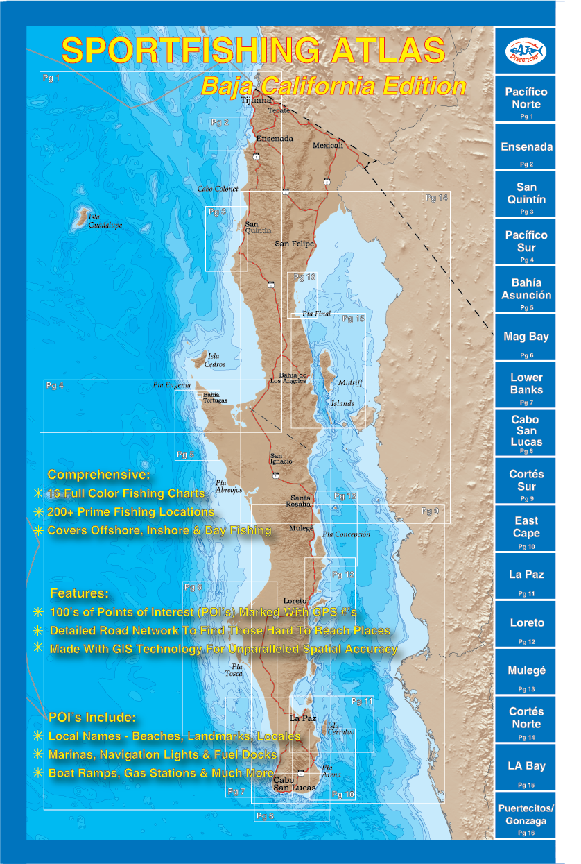
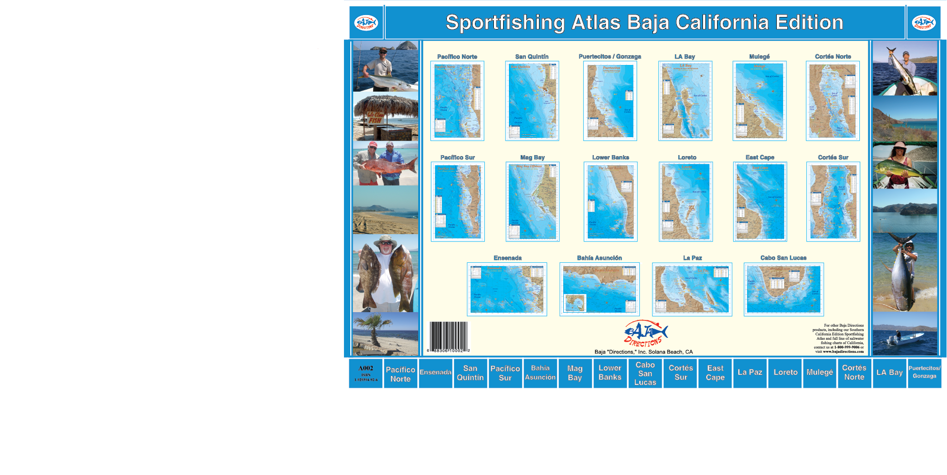
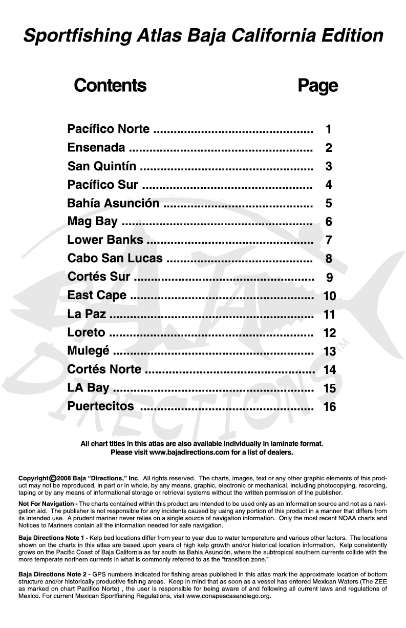
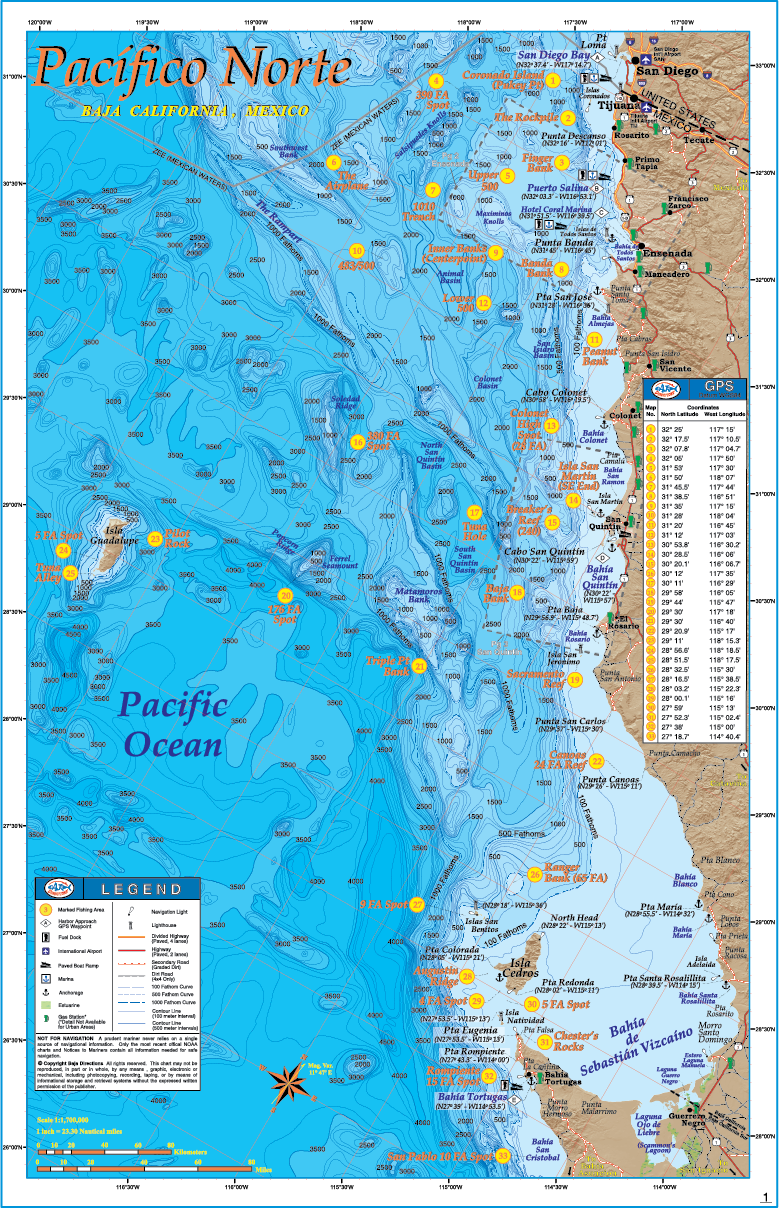
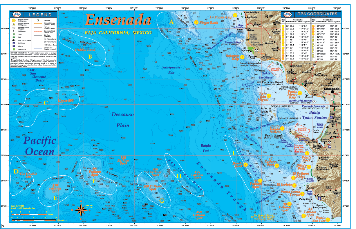
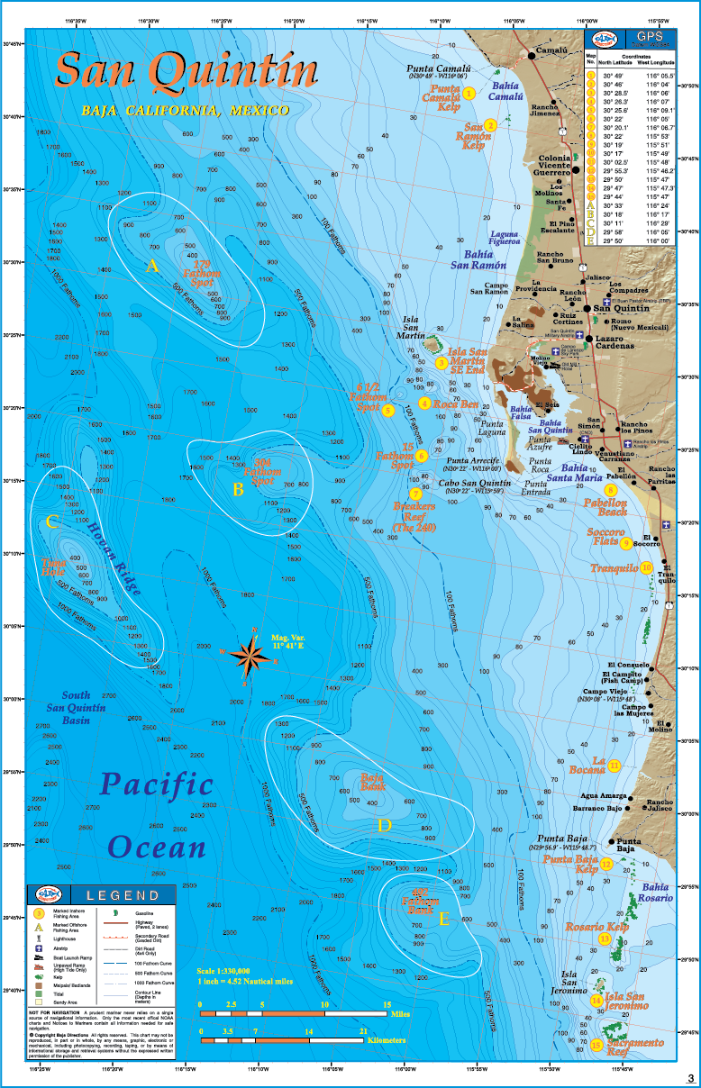
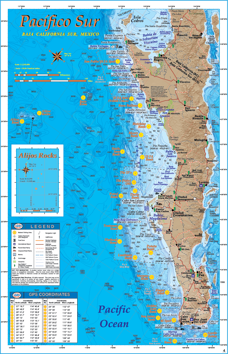
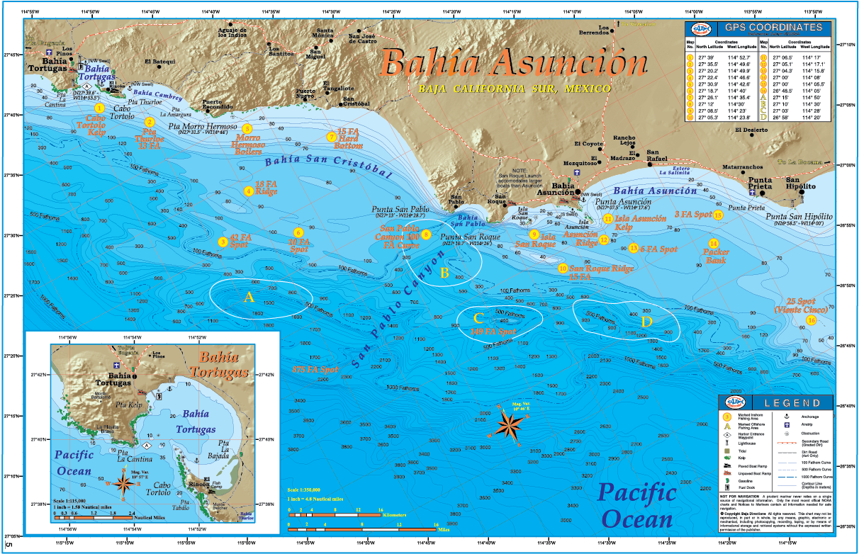
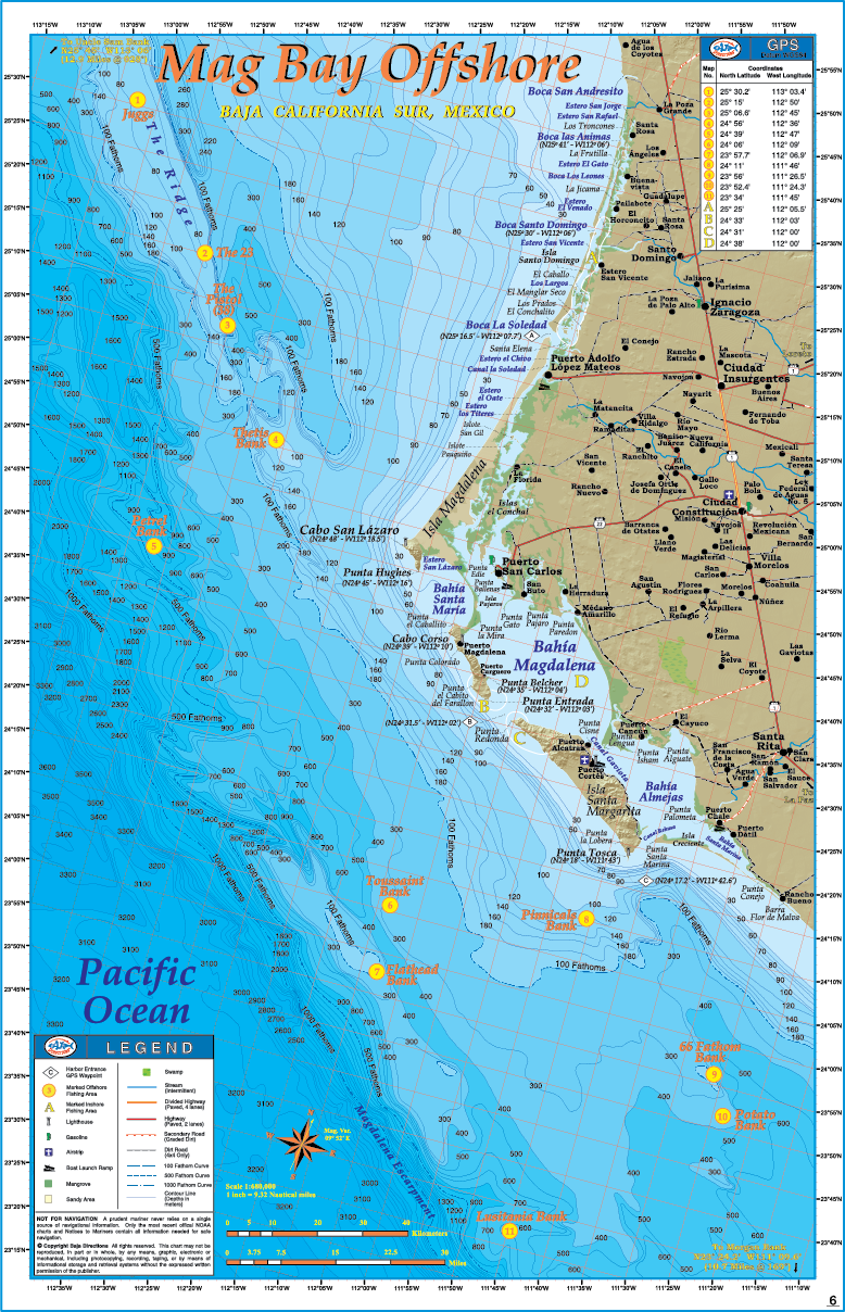
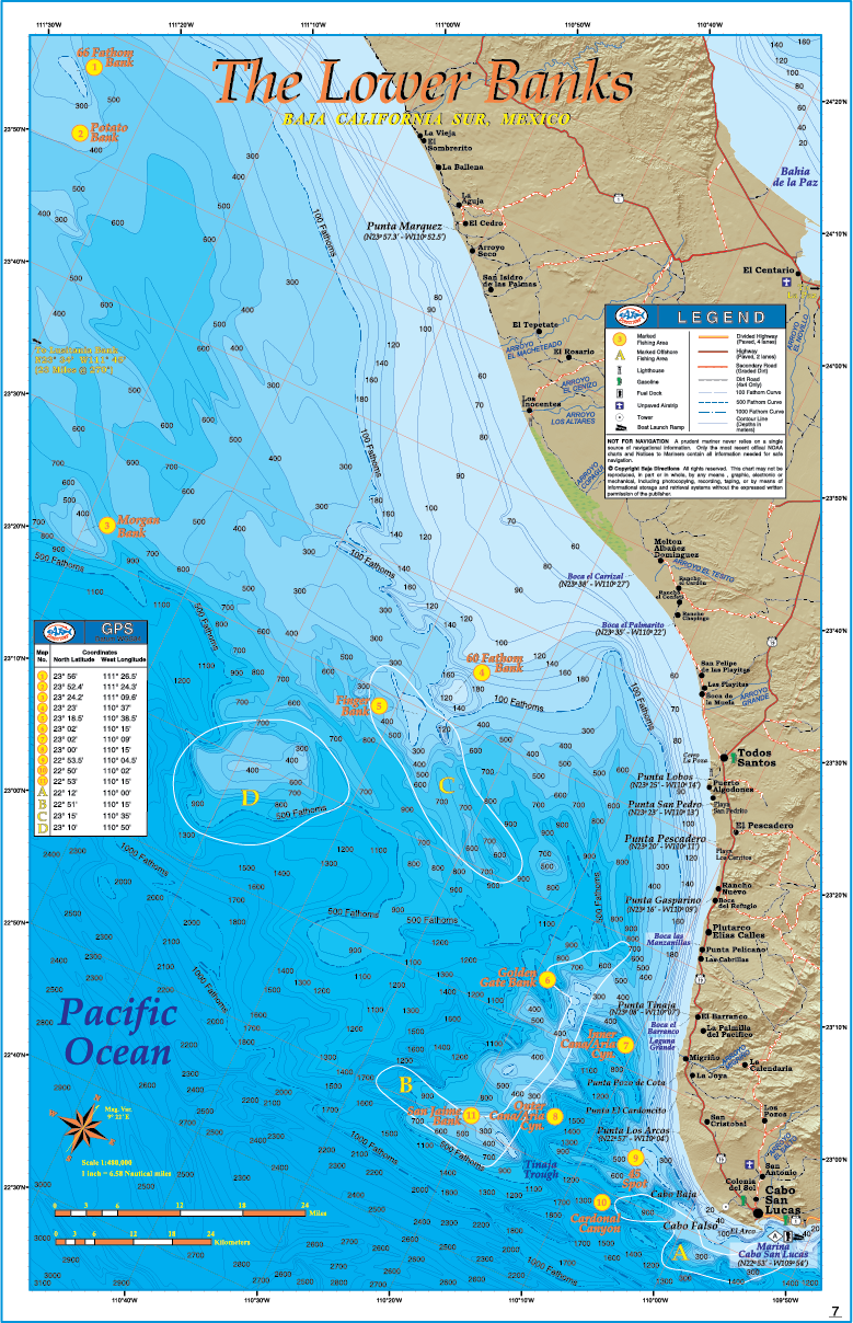
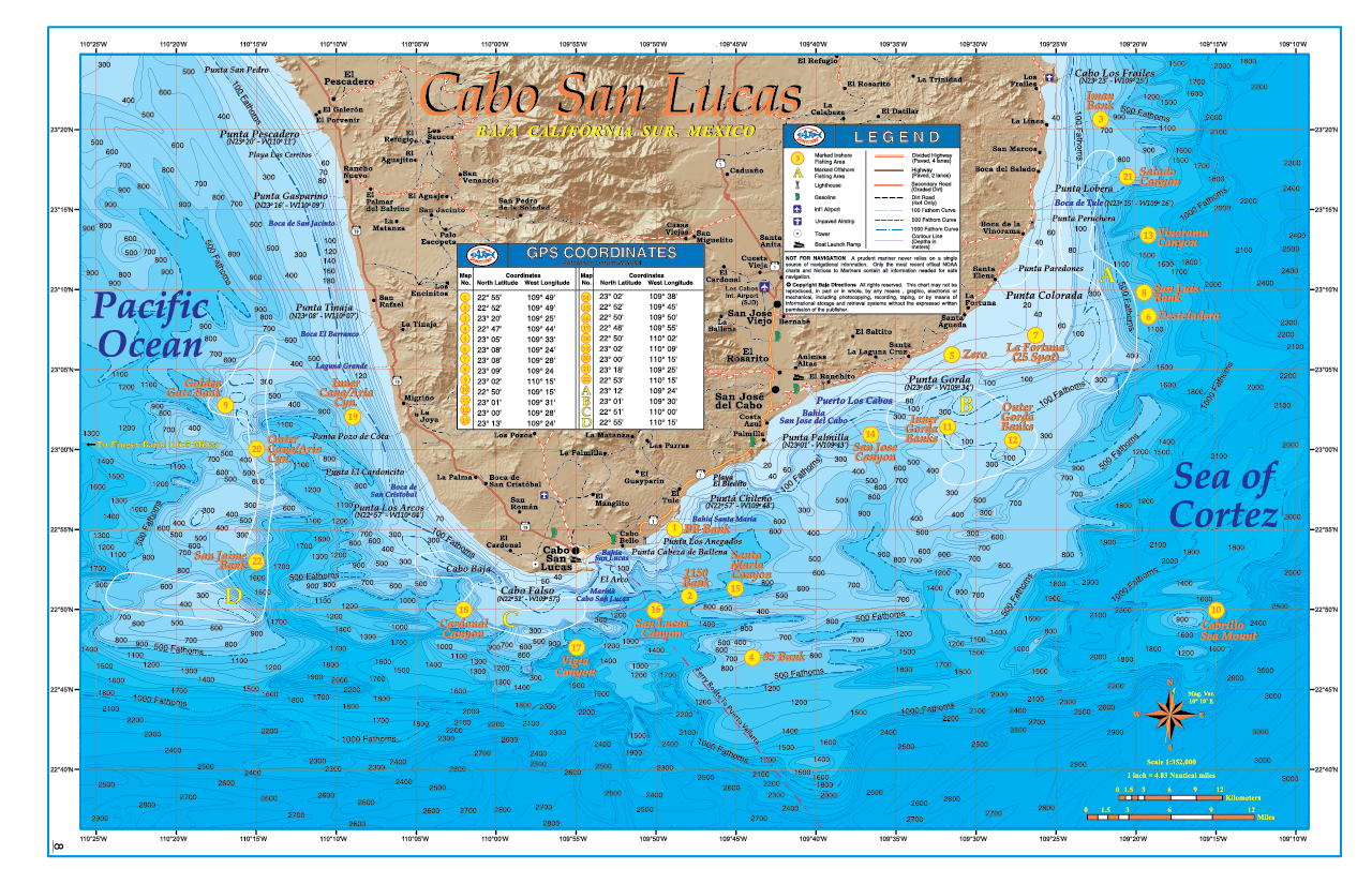
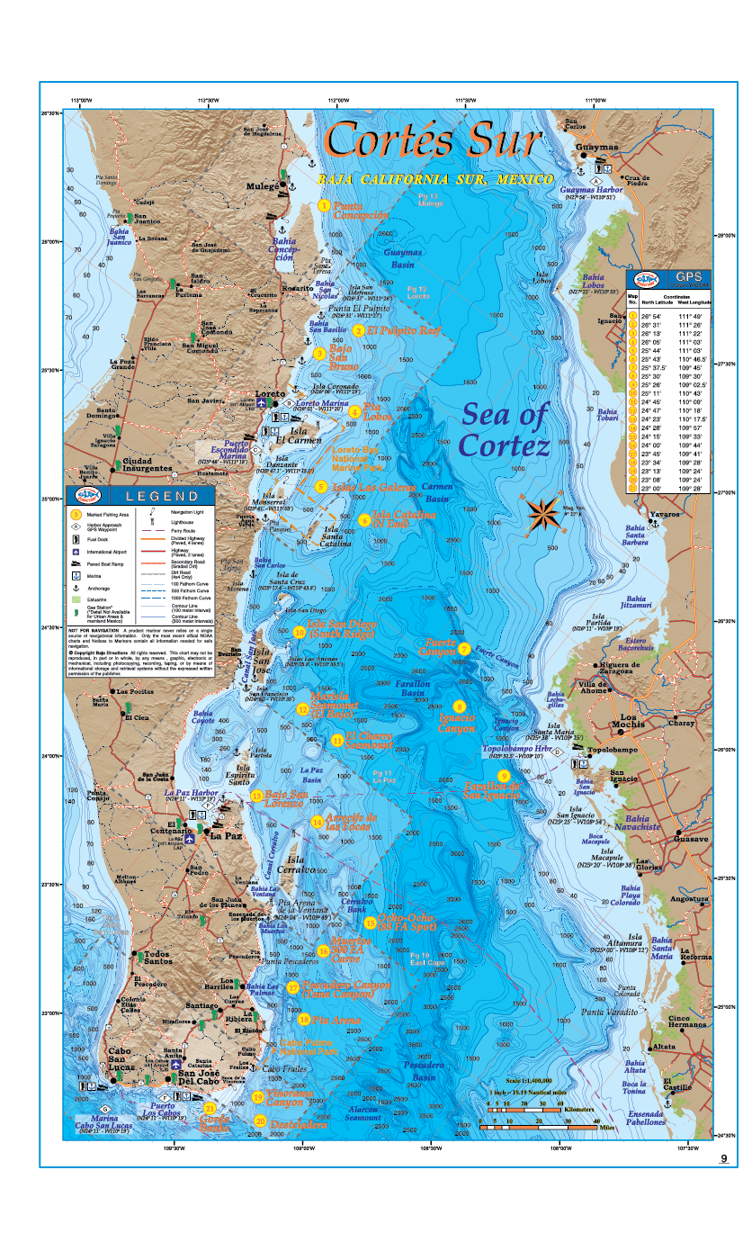
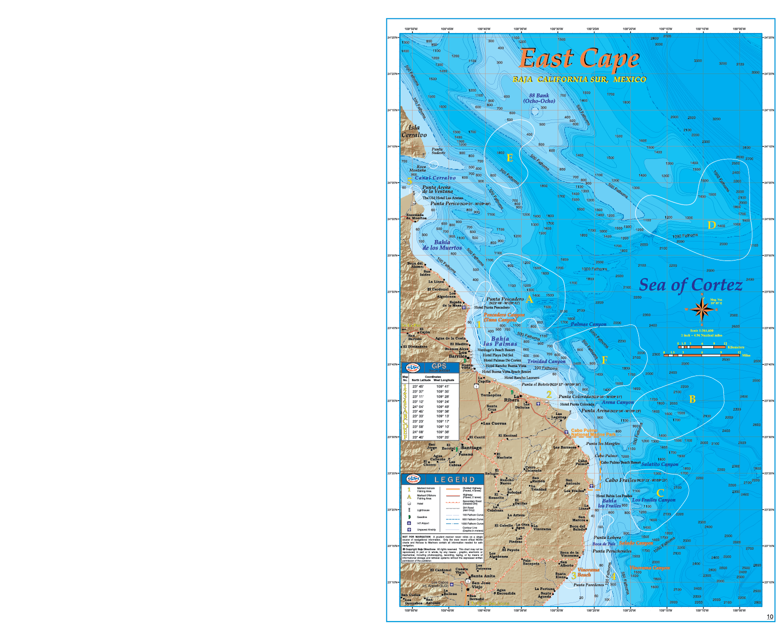
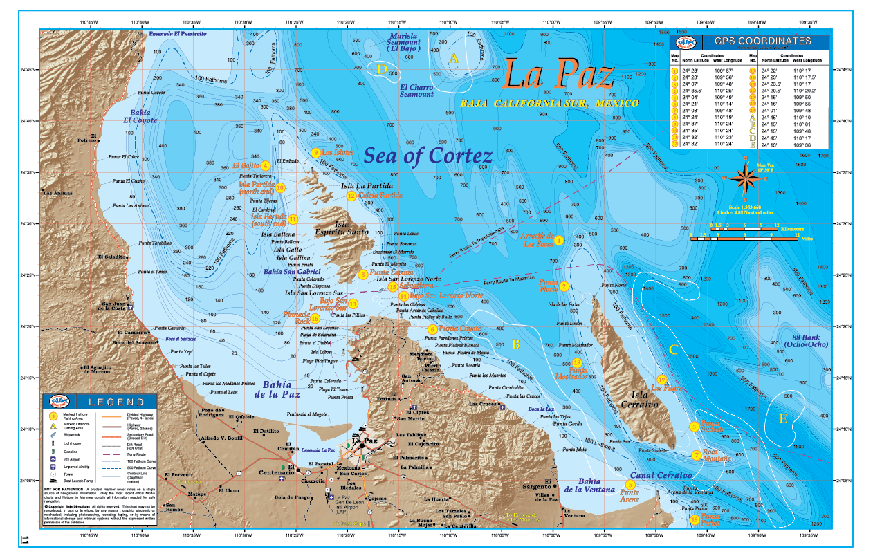
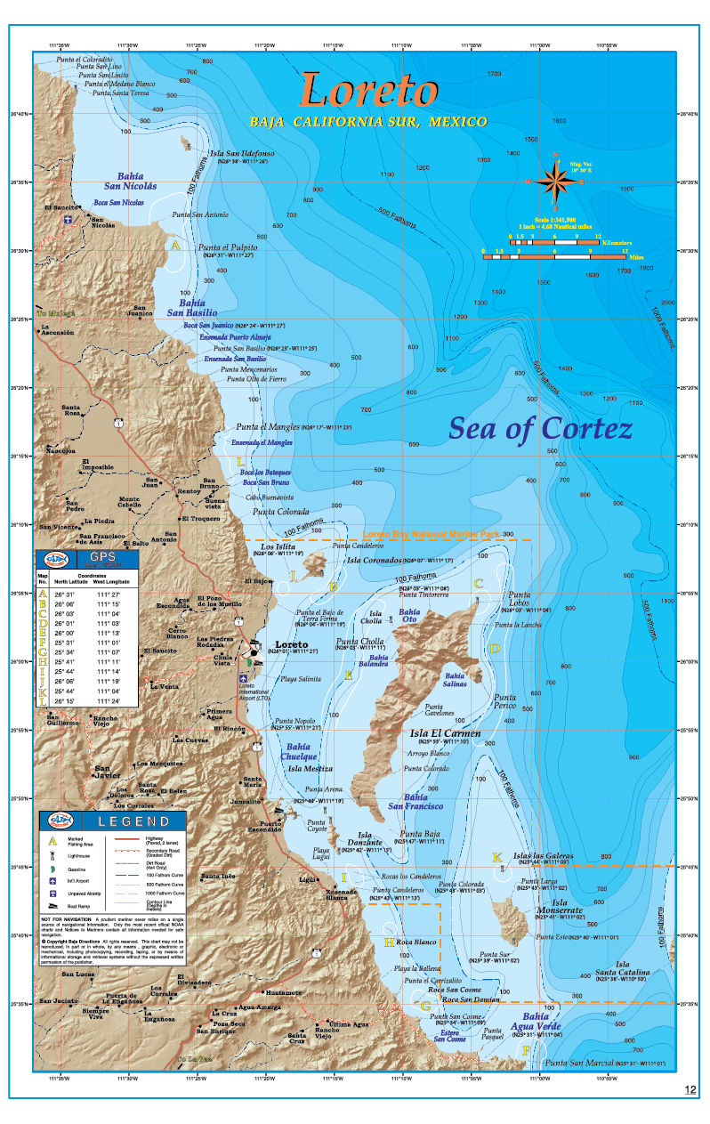
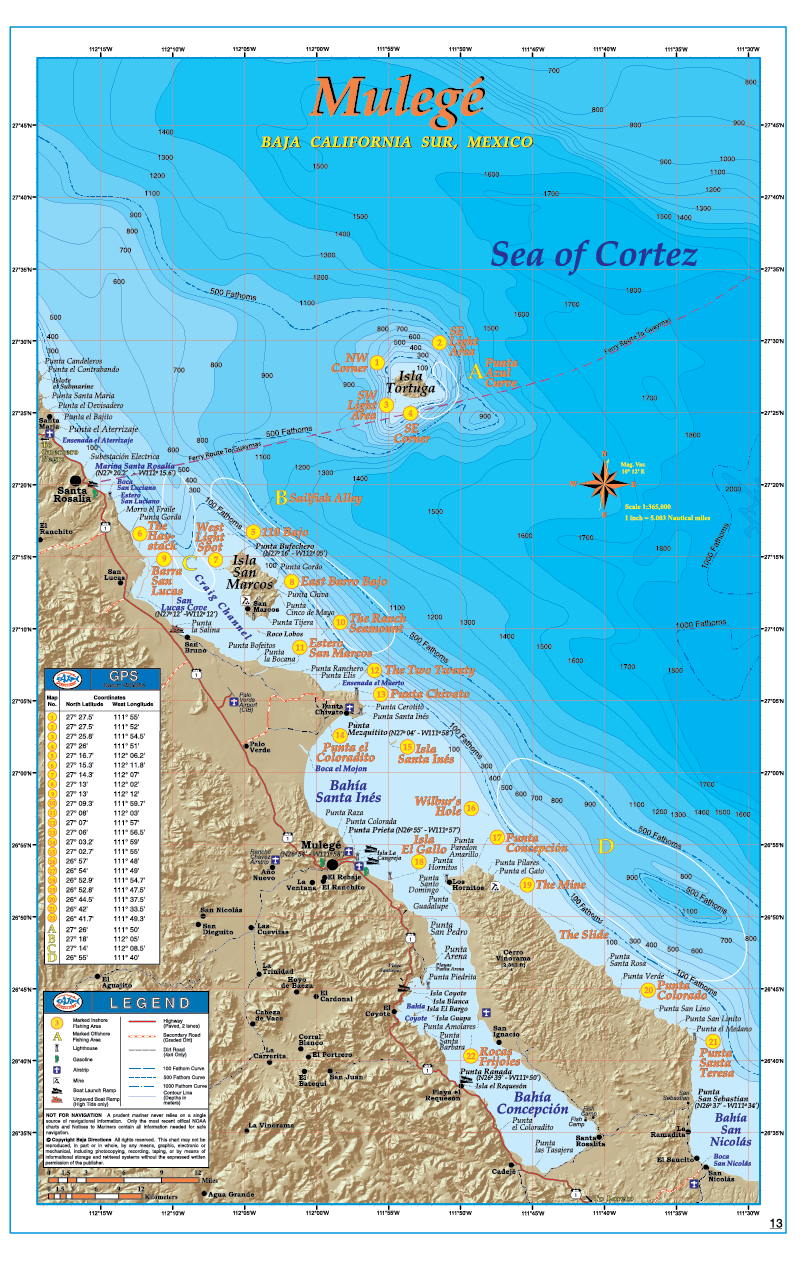
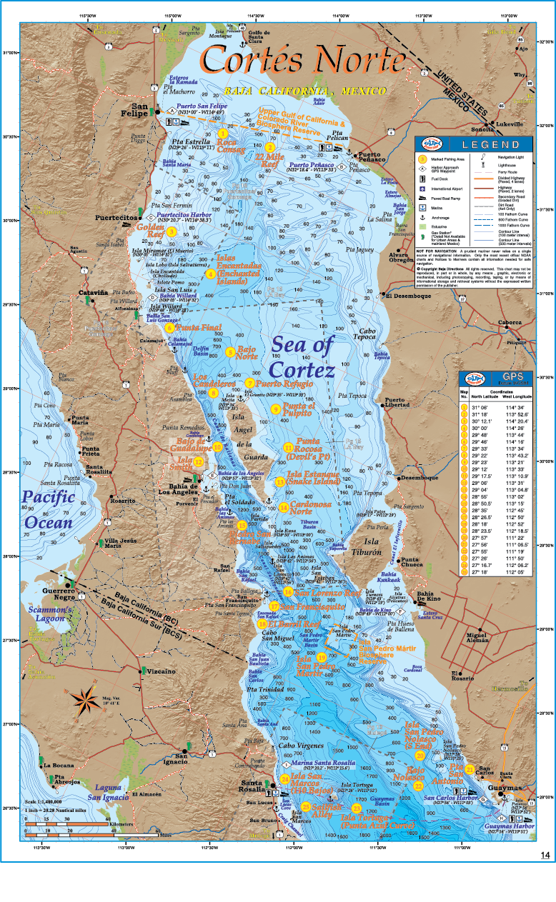
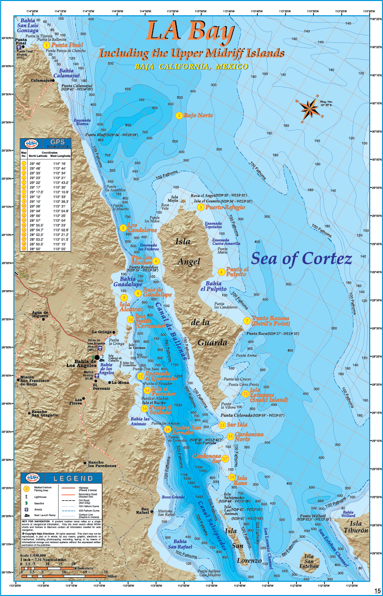
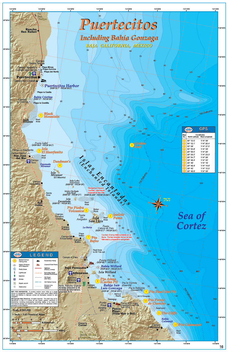
Years of research and thousands of hours in the making, the Baja Directions Sportfishing Atlas, Baja California Edition offers perhaps the most comprehensive look ever of the productive waters of Baja California, a region world-renowned for fantastic sport fishing. This atlas is a must-have for every Baja enthusiast. While cruising on the coast, trailering to remote locations or simply flying down and chartering a Sportfishing boat, the Baja California Edition atlas contains the type of detailed information that will enhance the experience for any sportsman. The atlas covers the region’s most popular Sportfishing destinations like Cabo San Lucas, the East Cape, La Paz and Loreto. The atlas features 16 charts in one product, and also contains 4 small-scale overview maps that combined cover every square inch of the Baja Peninsula, as well as 3 large-scale chart titles that cover the areas most requested over the years by Baja Directions’ customers. Every Baja enthusiast knows that information about the region is hard to come by. Road maps show vaguely what road conditions are like and where they go. Ocean maps of the region are dated and lack much detail of the ocean floor other than a handful of sparsely grouped depth soundings. Not only does Baja Directions Sportfishing Atlas Baja California Edition better both counts with detailed road information and the most detailed bathymetric maps ever made of Baja waters, but it also includes 100’s of GPS waypoints of the top fishing spots, prominent landmarks and harbors on both coasts, locations of important facilities like gas stations, marinas, fuel docks, boat ramps and more. Put simply, the Sportfishing Atlas Baja California Edition packs an incredible amount of hard-to-find information into one simple and easy to use product.
Reviews
There are no reviews yet.